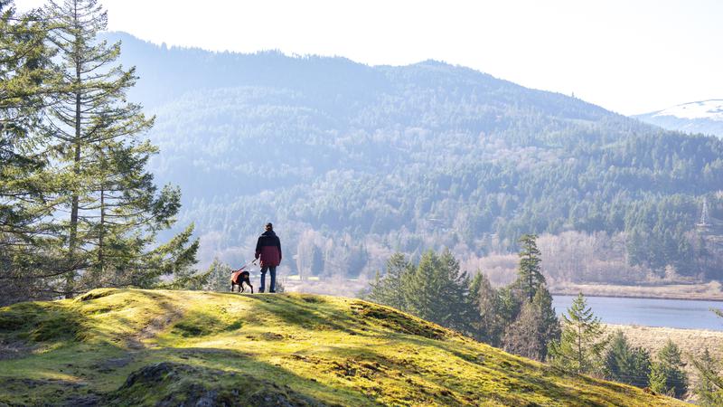
NANAIMO — Vancouver Island’s snowpack levels are holding strong as April also marks the start of wildfire season in B.C.
The April 1 snow survey and water supply bulletin provided by the Ministry of Water, Land and Resource Stewardship shows Vancouver Island at 86 per cent of the average snowpack levels for the start of the month, up from 76 per cent in March, and one of the highest in the province.
Jonathan Boyd from the B.C. River Forecast Centre said March was a fairly healthy month from a snowpack accumulation perspective, a big difference from this time last year.
“We went from being relatively healthy at the start of the year to dropping almost to the same levels as last year. By the end of February, we got storms and it felt like on the Island it was pretty wet all through March, so we just continued to get that snow accumulation. Relative to last year, the provincial average was 63 per cent of normal for April 1, so we’re now at 79 per cent.”
The Island reported 117 per cent of normal levels on Jan. 1 and down from 82 per cent in February.
Province-wide, the current level of 79 per cent was an increase from 73 per cent in March and 72 per cent in February, but down from 87 per cent recorded in January.
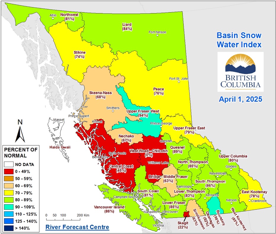 Boyd said the snowpack monitoring stations in West Road-Chilcotin (0 per cent) and Skagit (22 per cent) are located in much lower elevations than others, and are typically out of snow by this time of the year. (B.C. River Forecast Centre)
Boyd said they consider the April 1 report the “gold standard”, using it to compare historically to other years and a time when 96 per cent of the seasonal snowpack has typically accumulated.
April is also normally a “transition” month, depending on the weather.
“Sometimes we can melt early and then the snowpacks are already decreasing by May 1, but sometimes we can actually have increases if it’s a cool month with extra precipitation. We do see the greatest sort of impact of a La Nina year between March 1 and May 1 where we get kind of a cooler start to spring and additional precipitation.”
However, he said Environment Canada is predicting a warmer than usual next three months across the province, but it’s hard to predict weather patterns beyond ten days from the present.
Boyd said ideally, a cooler spring means slower snowmelt, thus reducing the risk of flooding, but he said that’s not a big concern for Vancouver Island.
“The atmospheric rivers that we often get from October even into early March bring far more water content in that short period of time than the melting of snow in springtime, so that’s primarily where Vancouver Island is most at risk for flooding.”
— with files from Jon De Roo/97.3 The Eagle.
Local news. Delivered. Free. Subscribe to our daily news wrap and get our top local stories delivered to your email inbox every evening.
info@nanaimonewsnow.com
Follow us on: Twitter (X) | Bluesky | Facebook